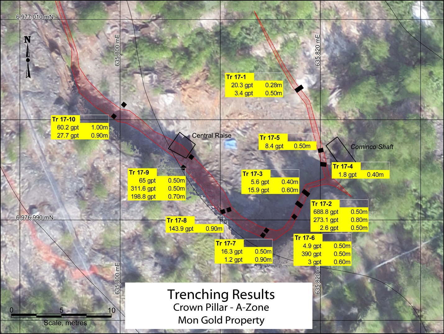
THE TRENCH Trenching = Picking + Digging + even small backhoe
I don'r see no blasting nor, hardrock broken from the main host rock.
Which is why my eyes see only dirt removed.
And if only dirt was removed - makes me think - loose free gold - placer.
Now i know i've been told it's hardrock... but.
I don't even see any signs of, broken rocks or blasted rocks.
Anyways.... those are someimpressive grades right at surface.
 Where could th trenching be located ?
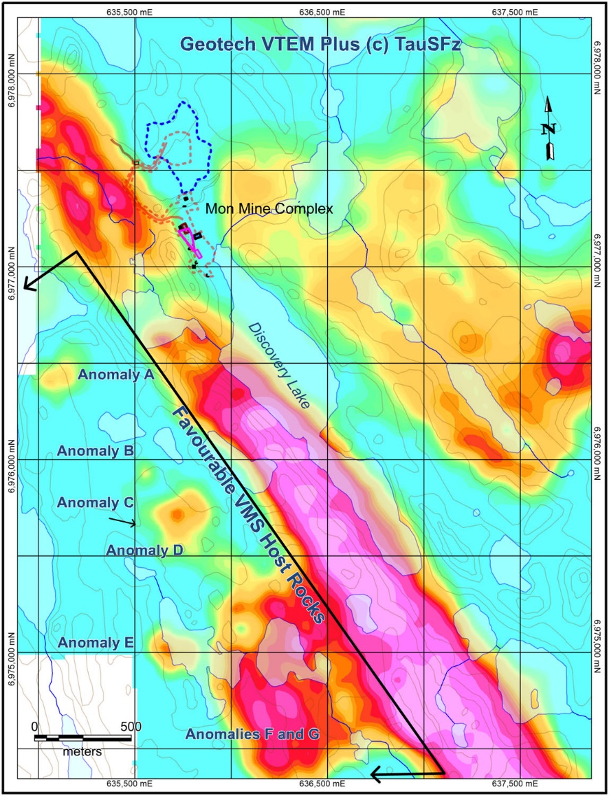
 Could it be the - V - pinpoint on this map below near the blue dotted circle ?
If this by chance is the V trenching location it's norrth of the main mine.
Well away from the mine entrances.
Entirely different geology than the - chaisng of veins.
What is so bewildering is....
All these years - main focus was only the - mine tunnels.
Trenching on the north side A zone - shows gold right at surface which appears to be in
loose soils with boulders and yes... hardrock.
What color is the mon mine for resistivity ?
Light Green.+ Aqua Green
What color is the V trench resistivity ?
Aqua Green, Light Green, Yellow. Pale Orange
Looks to me....
This gold can be in several color resistivity zones...
Interesting.
Something the junior should keep in mind when working with their 3D resistivity surveys.
Hell... look what happened to - Tusk - i did a quick review of that junior and saw how they
really went all out on thier 3D surveys - with inversions - and... they strcuk out.
I'm not abig fan of the 3D and inversions - i've come across severla juniors who experienced the same situation as, Tusk.
Iprefer the older mag tech surveys - and good ole chip and identify.
The 3D inversions has too many bells and whistles and tools that allow one to tinker with and at the end of the day... proof is in the drills - which if the drill striek out then what good is the 3D surveys ? ( just my own opinion )
i know Sixty likes their new found VMS target....
Seen in hot pinks.
But... look what the eastern outcrop on other side of Discovery lake has ?
Yeah.... same colors as, Mon Mine and V trmching.
That eastern outcrop ( right side of Discovery Lake is a good 2 km long.
With s potential - volcanic pipe at the south end - 250m easterly - tbt - looks like to me...
I would think = matching the hatch
Keeping to the same colorations of where gold has been proved and already mined
Aquas and light greens
would be the ideal forward plan... but, lets see hosw this junior proceeds.
I hope they think twice about the 3d surveys and inversions...

Here we can see the top end of Discovery Lake and the beginning of the outcrop that runs
all the way ot the potential - volcanic pipe at its lower end.

.