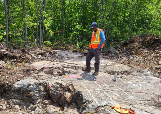
GLADE CHLORITES I'm seeing near surface chlorites - in this photo -
Apperars the Glade chlorites are closer to surface than that of Scadding - in my estimation
it might mean there's no poly capping to mow through and could also mean the gold
could be closer ot surface in this zonation -
BMK should be doing follow up drilling in small step outs to stay on the gold trend at Glade -
Few follow up holes to match the 22m intercept @ 5/g/t certainly ope nmy eyes.
Would love to see a small scout drill rig - portable - in which prescans the area with a good 4- 5 holes that penetrate to 20m priming the area for the larger dril lrig inwhich affords the larger drill best placement -
Why do so ?
Well - i reviewed BMK's former drill pad placements in thier photo gallery - even reviewed their channel cuts - doesn't take much to see a 3" drill hole miss a prime entry point that places the drill directly on th gold - similar to a dart hitting the bullseye - sometimes just a few degrees off to left or right - will make al lthe difference - and that translates into - successful hole or not so successful - i saw a few photos where the channels cuts should have made their cuts and where the drilling perhaps should have angled opposite direction - just saying - which is where a portable scout drill does the initial pin pointing ensuring the larger drill has the very best placement -
Yeah... very nice seeing this chlorite alteration so close to surface -
I wonder if Mike has any intel from former operators who drilled the powerline ?
I've tried finding intel on this - powerline - directly south of Scadding - but, there's limited intel.
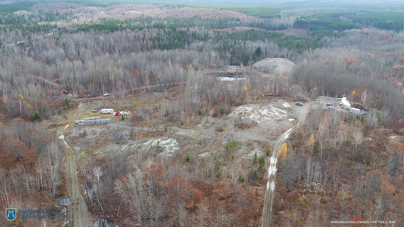
In this second photo - i'm seeing Kukugami road off to the left, and in the distance powerline is seen and perhpas Glade is seen where the open speace is extreeme distance at back of photo - near the Kukgami road.
If one opens this photo in another window - one might see - the distinction between the deciduous trees and confifer tress - i wonder if this could also give clue and chase to what geology might lie below grade - different trees assililating to specific ores whereas they thrive better sponging specific minerals - deciduous may prefer a specific - geology - whereas conifers prefer another.
Would be idea to take a canoe trip down the river off to the right side looking for transition zones that might provide better insight what;s belwo grade or convergence or contact zones that show deformations in the geology - applied to powerline and glade.
I'm also seeing - what appears to be an outcrop wall near middle of pic just off to the right - sands are seen just ot the left of this walled outcrop - this intruiges me give nthe terrain is more rolling with larger folds that are quite discreet and seeing a walled outcrop is most alluring.
If my eyes don't decieve me - parts of the rivder off to the right - appear raised
I could be wrong - but if the banks are raised - what an opportunity to analyze the exposed banks to see how the greology might change and transistion along the river - could be a good way to cross reference powerline and glades geological formations.
Now... if ever the river off the the right were a former - fault zone - such would be idea to drill in close proximinty to the river - looking for the deep seeded geothermal akais that perhaps influenced this area with the chlorite alteration - just might provide an answer to how the gold along with chlorites and carbonates impregnated this area.