Kenville Gold Mine; Nelson, BC
VANCOUVER, BC / ACCESSWIRE / July 29, 2021 / Ximen Mining Corp. (TSXV:XIM)(FRA:1XMA)(OTCQB:XXMMF) (the "Company" or "Ximen") is pleased to announce a summary of the results of a hydrogeology assessment completed for the Company's 100% owned Kenville Gold Mine project at Nelson in southeastern British Columbia.
The Company recently engaged Ecoscape Environmental Consultants Ltd. ("Ecoscape") to conduct a hydrogeology assessment of the Company's plan to construct a new underground decline at the Kenville Gold mine. The objective of the study was to provide an assessment of the likelihood of hydraulic connectivity between an underlying aquifer that the proposed decline that will pass through it.
The report concluded that the 113 domestic wells currently accessing the aquifer only demand 13,6 % of the annual recharge. The proposed portal at Kenville Gold Mine would have a negligible effect on groundwater supply in the aquifer. Further, the report concluded that it's not likely that there is any connection between the aquifer 511 IIB and Eagle Creek.
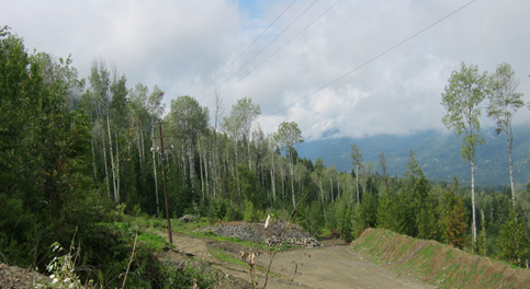
Photo showing access to the new portal site.
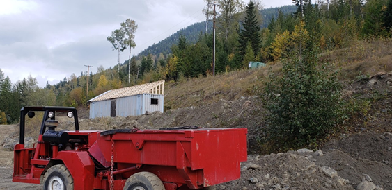
Photo of New portal site at Kenville Gold Mine.
Highlights of the report include:
- The Water Resource Atlas identifies aquifer 511 IIB as underlying the Kenville site. This domestic use aquifer is a fractured crystalline bedrock aquifer. The aquifer fact sheet lists it as not likely connected to surface water sources.
- Ecoscape's hydrogeology model indicates the top of bedrock Aquifer 511 is at a minimum of 30 metres below Eagle Creek and that Eagle Creek is perched above this aquifer and separated from it by unsaturated, low-permeability bedrock. Ecoscape concluded that it is quite unlikely that groundwater from Aquifer 511 upwells through the bedrock and overlying glacial till into Eagle Creek near the proposed site. As such, the bedrock aquifer is not likely hydraulically connected to Eagle Creek.
- Given the inferred deep depth to Aquifer 511 and the massive, low permeability nature of local bedrock, Ecoscape expects that nearby springs and drainages are fed by shallow groundwater that daylights in areas where the bedrock-overburden interface is exposed. As such Aquifer 511 is not likely hydraulically connected to these features.
- The proposed decline is away from nearby wells and will intercept groundwater at a distance greater than 520 metres from the nearest well. Along with a relatively low anticipated dewatering rate from the portal, Ecoscape expects a negligible effect on downslope water users.
- Portal dewatering is unlikely to significantly affect groundwater supply in the aquifer. The average annual groundwater recharge to the aquifer may be as high as 805,020 m3/year. Based on conservative estimates from 113 domestic wells, users would require aquifer demands of approximately 103,169 m3/year or 13.6% of estimated annual recharge.
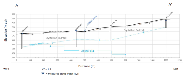
West to East Conceptual Schematic Cross Section