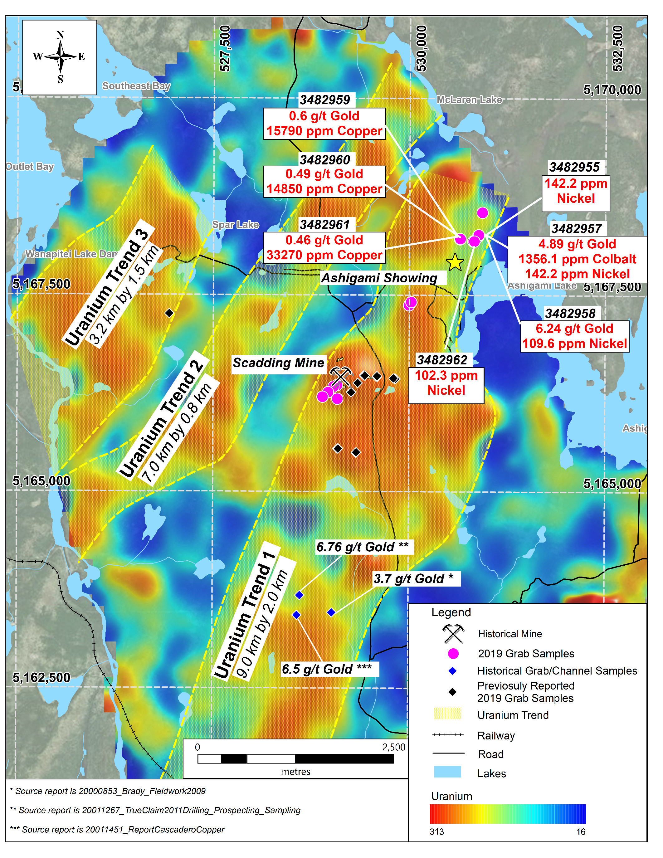
2019 - SAMPLING WEST OF SCADWHAT WAS FOUND ? West of the Scadding Deposit, surface work revealed that sodic alteration (the addition of sodium (Na)) extends 250 metres west of the known footprint of the deposit. Sodic alteration has been shown to be associated with gold-rich chlorite zones in the Scadding Deposit. This observation indicates that the gold bearing system remains open to the west. COULD ONE REPLACE THE YELLOW LINES ?
PLACE THEM IN A DIRECTIAL FLOW FROM - NW - SE ?
The gold is near surface - if one did replace the yellow lines
and arranged them from south bay to south east - it appears
it leaces gaps inbetween the iron red anomlaies and it could very well
allow placer gold to flow into the top end of scsad and west side of scadand south of scad.
The new arrangement of lines = permits open spaces for the gold to come in via sodic salts and lime waters - allowing for gold ot deposit against the rims of the iron formations.
One can't discount that Wanapitei Lake could be a strong point inwhich asissted with the
gold depsoiting in, limes, salt ores...
On the map belwo - there is one smaple taken west of scad - seen by a small
black diamond - i would say its the wrong side of the red anomaly - all three other sides
would be the obvious sides ot sample if Wanapitei was involved in the gold depsoits.
Same sampling style for al lother red perimeters...
Just my own opinion.
 LINK -
 https://insidexploration.com/macdonald-mines-grab-samples-3-5-km-from-scadding-mine-indicate-potential-for-large-deposit-at-the-spj-property/