WESTERN INFLUENCE ?Can i present a hypothesis ?
Why not - right ?
lol
Is it possible that this western granite formation " altered " the Mon Mine outcrop ?
Could the Mon Mine been apart of the lower outcrop that runsadjacent to Discovery Lake ?
In my own opinion - it appears there's a strong correlation to the southerly outcrop that runs aside of Discovery lake to that of, Mon Mine - outcrop.
My own hypothesis ?
Western granite influence pushed or segragated Mon outcrop away from it's original mineral body creating an offset outcrop -
Discovery Lake might have a fault line that runs alongits west side and connects to the small lake - potential - pillar style pipe or spouted anomaly.
All along Discovery's western shoreline has gold showings.
( based on Sixty's geo map logging )
If one were to shift Mon Mine sliughtly to the east - it would align perfectly with the lower elongated outcrop - my hunch says - highly probable it's the same system but somehow brokeaway from its original embodiment.
If my hypothesis is at all accurate - it would outline a pretty good strike path -
And if my second hypothesis is at al laccurate ( potential ) fault zone along side of
Discovery lake leading right to a potential - pipe zone - such would support the theory of
it's the same system as Mon Mine but somehow - separated from its original elongated folded outcrop system.
MAPCARTA Map opens at - Clan Lake
Aim 5.5 km south west - arrives at - Mon Mine
To the left you'll see Nelson lake
Nelson has a nipple looking Bay - that points to a small - lake
This small lake is in between Nelson and Discovery lakes.
https://mapcarta.com/24191716/Map I'll also add - would be interesting to see Sixty check for placer gold in the lower lying regions.
There's significant signs of massive water errosions that created numerous shelfs all over.
Those water erroded ores would certainly create concentrated pocket zones of gold at specific choke points - just saying.
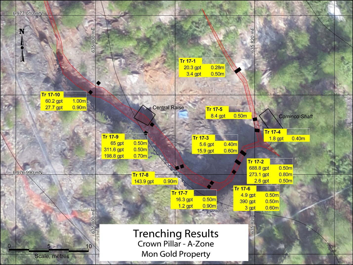
Sixty's latest channel cuts - trenching - many are only - 1/2 meter at depth.
Hard not to think - placer gold.
And given the geology of land - it kind of looks like the chaneel sampling was performed
in what appears to be - potentially - former older creek bed. While other channel sampling does appear to be at higher grounds.
I could be wrong - have a look for yourself...
