Join today and have your say! It’s FREE!

Become a member today, It's free!

We will not release or resell your information to third parties without your permission.
Please Try Again
{{ error }}
By providing my email, I consent to receiving investment related electronic messages from Stockhouse.

or

Sign In

Please Try Again
{{ error }}
Password Hint : {{passwordHint}}
Forgot Password?

or

Please Try Again {{ error }}

Send my password

SUCCESS
An email was sent with password retrieval instructions. Please go to the link in the email message to retrieve your password.

Become a member today, It's free!

We will not release or resell your information to third parties without your permission.
Quote  |  Bullboard  |  News  |  Opinion  |  Profile  |  Peers  |  Filings  |  Financials  |  Options  |  Price History  |  Ratios  |  Ownership  |  Insiders  |  Valuation

Sixty North Gold Mining Ltd C.SXTY

Alternate Symbol(s):  SXNTF

Sixty NorthGold Mining Ltd. is a Canada-based company, which is developing mining operations for gold on the 100% owned Mon Gold Property, approximately 40 kilometers (km) north of Yellowknife, Northwest Territories (NWT). The Mon Gold Property consists of over 13 contiguous mining leases encompassing approximately 494.28 hectares and one mineral claim, comprising an additional 127.75 hectares, located in the South MacKenzie Mining District, NWT.


CSE:SXTY - Post by User

Post by Wangotango67on Jul 19, 2021 1:43pm
189 Views
Post# 33569857

INTERESTING - PICS

INTERESTING - PICS
Here's a few pics
( discovery lake out crop + escarpment / shelf )  fringing - 20 man camp -

Now, isn't the A zone trenching above the mon mine - would it be in this valley area ?
right click the picture in another window and really zoom in -  this valley area just off the small escarpment intruiges me - especially if the trenching is in this area carving out ores around high points - and in a valley - ha....  makes me wantot see the trnched out gold all the more - i wonder if this is the nuggety gold spoken of in the 43 101 ?
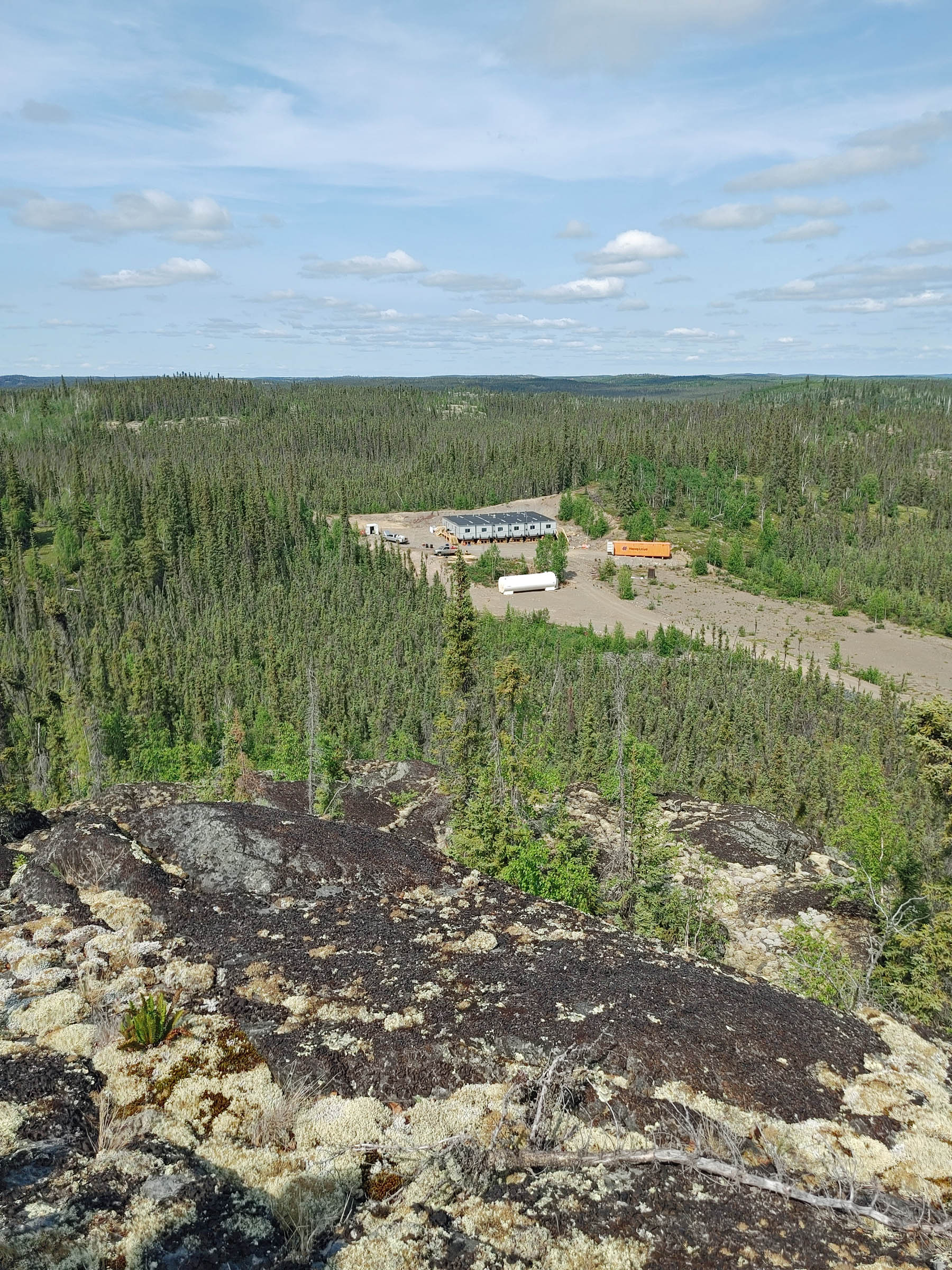

https://www.sixtynorthgold.com/site/assets/files/3625/camp_from_a-zone_2021-07-01.jpg


This photo below also intruiges me....
Again open in another window and zoom in.
I'm seeing 3 types of strata layers on the Discovery outcrop in back scene.
A deep dark strata at bottom
A mid zone strata
And a topper strata.
And.,... what's so appealing ?
I'm seeing rounded rocks burried with in the strata -  rounded rocks = most often points to
watershed sediments - 3 phase deluge.

Would be nice to see a younger team member strap a rope and harnass on wrap around a few trees and scale the outcrop - collecting samples in each strata layer -  all open  face - easy to read the geology and know what happened long ago - amazing picture - a an ope nwindow into the past.


https://www.sixtynorthgold.com/site/assets/files/3625/float_plane_2021-06-24.jpg


<< Previous
Bullboard Posts
Next >>