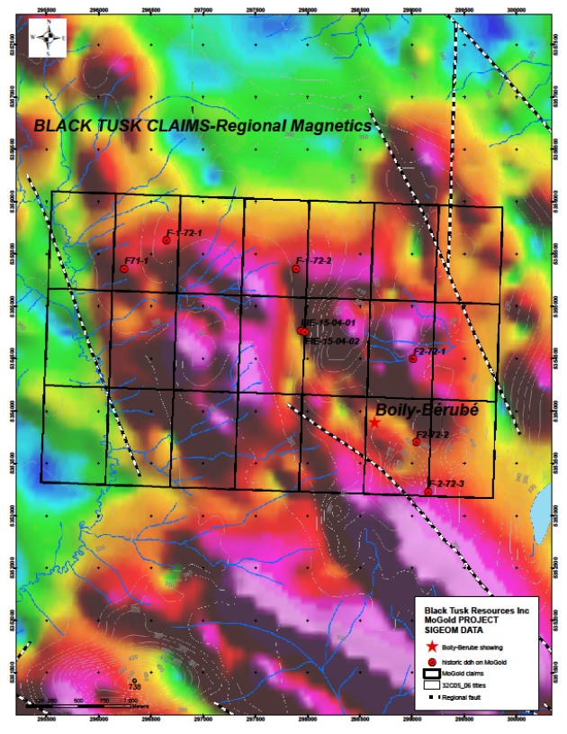
DISCRIMINATION TECHNIQUES I would advise Tusk to do a ( real quick ) test of the ( green zone ranges to see if there's elevated copper, zinc, in the sediments. There's a few
streams coming off the green ranges seen in photo below - that could provide a quick assessment before comitting to a drill program in order to decisively rule out these green resistivities that may or may not harbor what they're seeking.
INSIDE THE CLAIMS GRID - 2 partial green ranges extreme west.
- North of claims grid are 2 othr ranges that flank a small lake.
- could be easy testing this area for elevated copper or zincs that might associate to a
weak mag resitivity shown in greens.
Sometimes going total opposite to a strong magnetic anomaly proves where the minerlas are hiding. If we examine the historical drill hits - there no more than a meter in width.
Such suggests - sedimentry sheets - old oceanic sediment bands.
My reasoning in which asks to do a double take on the - green ranges - could prove that the regiojnal area has seen considerable watersheds of the sodic kind - if conclusive, it might point ot the green ranges are remnant seconday range depoists - loose tills that might harbor elevated levels of concentrated minerals that have paired with the salts or carbonates .
Again.... i know how tempting the high mag zones are - a definite attractant, but....
Copper and Gold and Zinc are non magnetic.
If historical sediments are of thin intercepts then, this could also translate into a mathematical
equation or comparison of, seeking diseminated sediments that liberated and reconsolodated forming thicker porphyry depoists or, sticking to thin 1m intercepts at depth.
Just saying.
Rule out the green colored zones - it at least preps the dril program targeting the Gorilla Face zone... wink. Or, the Chimp face zone... lol
Maybe these zones have the sediments sheets arched up on an angle which formed the ranges - find the right pitch might assist with more successful drill hits. which begs - which side of the range " could " a sediment sheet have formed, west side facing east or,
east dide facing west ? Could be even north and south and a seismic push in the latter that created an elongated range... who knows, i can't see the ranges in satalite mode, if i had a lake to reference from i could - wish i did.
