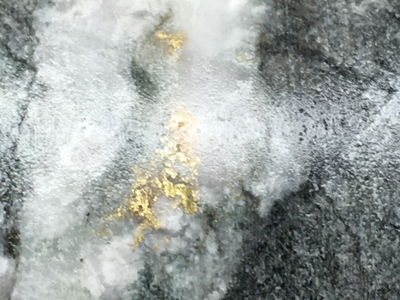
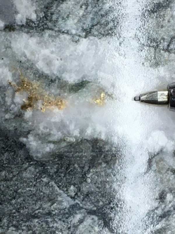
Opawica Intercepts Visible Gold Vancouver, B.C. – TheNewswire - February 7th, 2022 - Opawica Explorations Inc. (TSXV: OPW) (FSE: A2PEAD) (OTC: OPWEF) (the “Company” or “Opawica”) is pleased to provide an update on the continuing maiden diamond drilling program on the Company’s Bazooka property in the Rouyn Noranda camp of Quebec.
Highlights include:
-
••From mid-December to date, eighteen (18) holes have been completed on the Bazooka, comprising 3,810 metres. Assays are pending.
-
••18 holes targeted the Cadillac shear zone intersected prospective geology with a varying amount of quartz veining, brecciation and silicification, and quartz stockwork, with associated sulphides.
Company President and Chief Executive Officer Blake Morgan commented, “The drilling progress, encouraging visual geology and the observation of visible gold in the core on the Bazooka Project are an excellent start to our maiden drill program. We are expediting the logging, core cutting, sampling, and assaying of the prospective zones. With 21 holes still to be drilled in this initial program, Opawica is very encouraged with what has been seen so far.”
Bazooka Property
The Bazooka property occurs along one of the most prolific auriferous structures in the world, the Cadillac-Larder Lake break/fault. The Cadillac-Larder Lake break/fault, in part, marks the boundary between the Archean Abitibi sub province in the north and the predominantly metasedimentary Pontiac sub province south of the fault.
Gold mineralization on the property occurs within mixed, up to 60-metre-wide (estimated true width), strong quartz-carbonate-sericite and talc-chlorite schists of sedimentary and ultramafic to mafic volcanic protoliths, respectively, and is referred to as the Main zone. The alteration and mineralization are spatially associated with the Cadillac-Larder Lake.
The break/fault zone is at the base and is characterized by up to two-metre-wide (estimated true width), strongly graphitic fault. The graphitic fault generally marks the contact between the sedimentary and ultramafic metavolcanic rocks.

Click Image To View Full Size
Structures and hydrothermal pathways were interpreted using the co-occurrence of selected exploration criteria in drill hole data. Interpreted prospective panels trend generally east-west with a steep dip to the north. They are constrained within the northern and southern borders of the Cadillac shear zone, a 150-metre-wide corridor of highly carbonate-chlorite-talc altered and schistosed ultramafic units, which form a Z-shape asymmetric drag fold in the area of the Bazooka historic mine.

Click Image To View Full Size
Figure 1 Visible gold in OP-21-13 @ 150.60 m depth
Derrick Strickland, P. Geo (OGQ No. 35402), is the qualified person for Opawica Explorations, and has reviewed and approved the technical content of this news release.
About Opawica Explorations Inc.
Opawica Explorations Inc. is a junior Canadian exploration company with a strong portfolio of precious and base metal properties within the Rouyn-Noranda region of the Abitibi Gold Belt in Qubec and in Central Newfoundland and Labrador. The Company’s management has a great track record in discovering and developing successful exploration projects. The Company’s objective is to increase shareholder value through the development of exploration properties using cost effective exploration practices, acquiring further exploration properties, and seeking partnerships by either joint venture or sale with industry leaders.
https://opawica.com/
https://www.thenewswire.com/press-releases/1LPRFoONM-opawica-intercepts-visible-gold-in-hole-op-21-13-at-bazooka-project.html