Join today and have your say! It’s FREE!

Become a member today, It's free!

We will not release or resell your information to third parties without your permission.
Please Try Again
{{ error }}
By providing my email, I consent to receiving investment related electronic messages from Stockhouse.

or

Sign In

Please Try Again
{{ error }}
Password Hint : {{passwordHint}}
Forgot Password?

or

Please Try Again {{ error }}

Send my password

SUCCESS
An email was sent with password retrieval instructions. Please go to the link in the email message to retrieve your password.

Become a member today, It's free!

We will not release or resell your information to third parties without your permission.

MGX Minerals Inc MGXMF

MGX Minerals Inc. is a Canada-based diversified resource and technology company with interests in advanced materials, metals, and energy technologies. The Company’s portfolios include Magnesium, Silicon, Lithium, Gold, and Silver. Its Magnesium projects include Driftwood Creek, Marysville, Red Mountain Group and Botts Lake. Its Silicon projects include Gibraltar, Koot and Wonah. Its Lithium projects include GC and Petrolithium. Its Gold projects include Heino, Tillicum and Fran. The Driftwood Creek project is located approximately 164 kilometers (km) north of Cranbrook, British Columbia (B.C.). The Marysville magnesite project is located approximately 12 km (7.7 miles) south of Kimberly, BC. The Red Mountain-Topaz-Cleland magnesite property is located approximately 50 km south of Golden. The Botts Lake magnesite property consists of claims approximately 50 km south of Golden, BC. The Gibraltar project is located approximately 95 kilometers northeast of Cranbrook, BC.


GREY:MGXMF - Post by User

Post by Wangotango67on Jun 20, 2023 11:18pm
160 Views
Post# 35506463

FAULTS or FOLDS ?

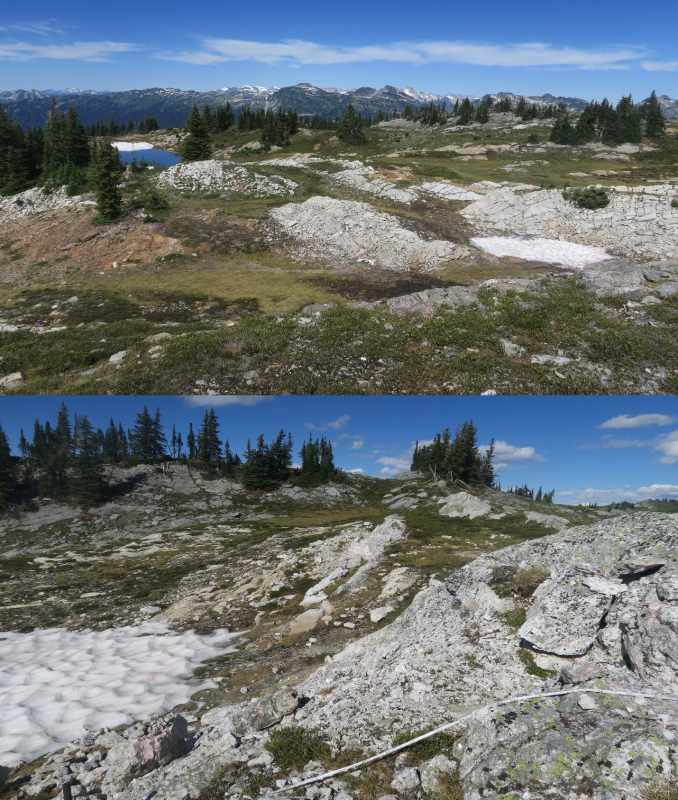
FAULTS or FOLDS ?Earlier today - i noticed MGX's drill map image
revealed the rolling terrain land.

I questioned,  what if ?
What if the 3 geologies are throughout GC claims and are
associated to the numerous rolling folds seen in mgx's image below ?

  Only overlays i've added are...
- blue dotted lines showing rolling folds
- yellow dotted circle proposed drill location
- white arc - potential connective to larger blue fold

- white dotted line rolling fold
( match with mgx's 2 dotted black lines )
i'm guessing my own white line fold  - could be the area
where the measuring tape was seen in photo...?
total of 3 folds ( 2 pegs + 1 grey fold outcrop ).

MGX's 2 black lines are labelled - faults.
Diff geologies does support this...

Yet, the rolling folds enter into the pegmatite zone
which suggests the peg's are apart of the outter rolling folds.

Here.... have a look,
compare grey image with actual photo.
I'll position the image and photo close together so
one can compare.

https://live.staticflickr.com/65535/52990263464_ac513aa857_z.jpg
https://thenewswire.com/data/tnw/clients/img/0c75cf97e8f0da60b90627bdc15b6731_.png


Former post correction
- Vanta ( xrf )
- distant grey outcrop approx 70m  ( yellow oval former post )


<< Previous
Bullboard Posts
Next >>