Thomas Ullrich, CEO of Aston Bay. ,
Highlights - Field program will commence in March 2024 focused on resource expansion/definition and exploration
- Extensive 22,000 metres (m) reverse circulation (RC) and diamond drilling program planned with a focus on:
- Testing the extensions of the mineralized zones at Storm (National Instrument 43-101 maiden resource anticipated to be released in March-April, 2024)
- Resource definition of the known high-grade copper (Cu) discoveries at the Thunder (48.6m @ 3.0% copper (Cu)), Lightning Ridge (30.4m @ 2.2% Cu) and The Gap zones (1.5m @ 4.4% Cu and 2m @ 2.5% Cu) at Storm
- Exploration for new high-grade copper zones along strike and below the existing prospects and copper discoveries
- Exploration along the prospective >100 kilometre (km) long copper belt including the Blizzard, Tornado and Tempest prospects
- High-resolution surface electromagnetic (EM) surveys are planned at the underexplored Blizzard, Tornado and Tempest Prospect areas
- Permitting roadmap continuing with environmental, mining and metallurgical studies underway
"We are excited about this significant exploration program at Storm," stated Thomas Ullrich, CEO of Aston Bay. "partner American West is fully financed and currently coordinating mobilization in order to conduct the 2024 resource expansion and exploration program. Geophysics and 22,000m of planned drilling will focus on expanding the known areas of near-surface high-grade copper mineralization at several prospects at Storm, as well as continuing to explore for new targets at depth and along strike over the almost 100-kilometre prospective trend for sediment-hosted copper mineralization.",
12,000m of drilling have been planned for resource expansion activities in the Storm area. These activities will commence during March/April 2024. 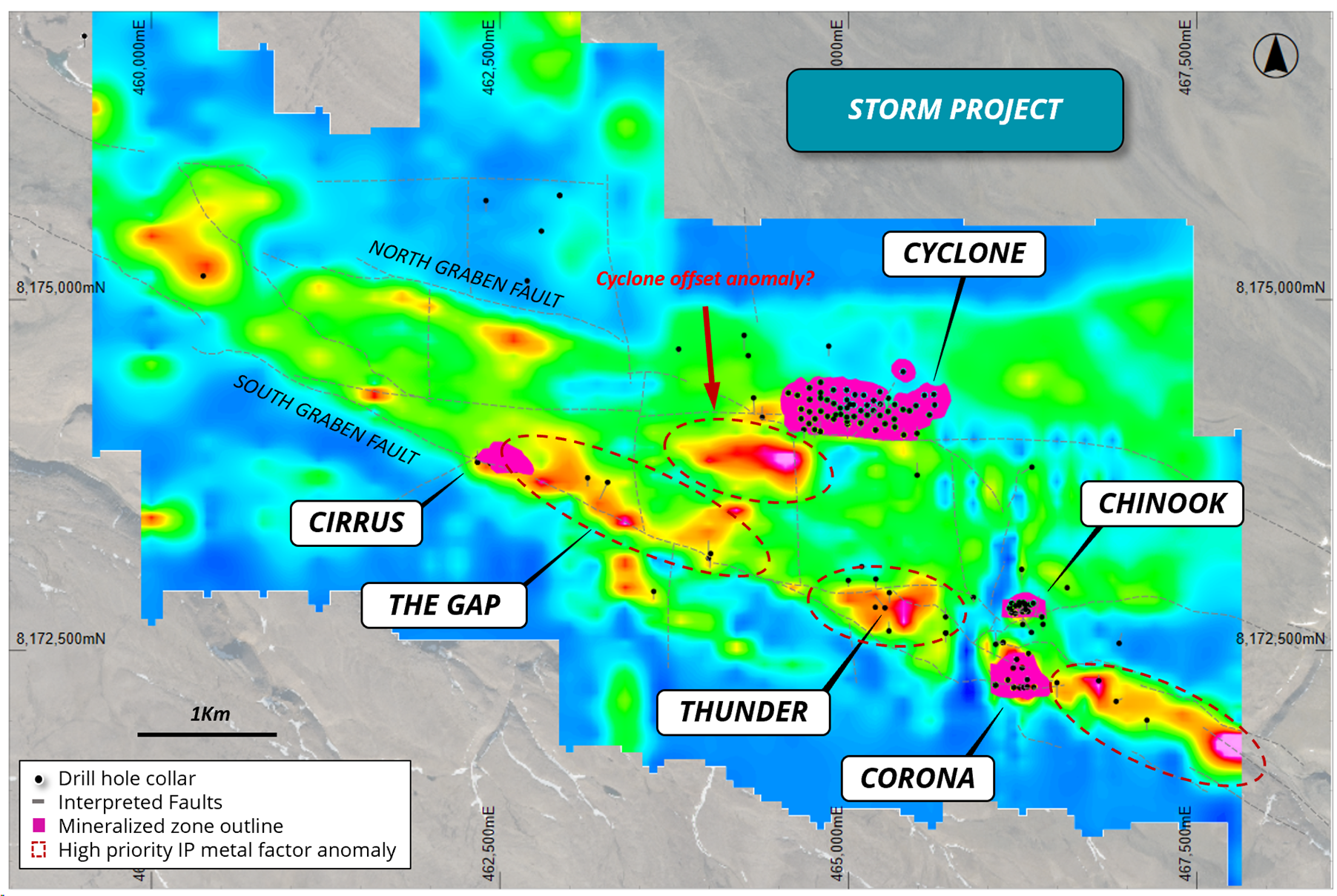
Figure 3: Plan view of the Storm area showing the known copper deposits and drilling, overlaying IP metal factor imagery (Hotter colours indicate higher conductivity contrast) at -100 to 200m depth
BLIZZARD AND TORNADO PROSPECTS
Moving Loop Electromagnetics (MLEM) and drilling will be used to follow-up these prospective areas with the aim of defining another Storm-style copper camp along strike of the existing copper resources.
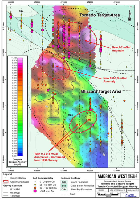
Figure 4: Gravity anomalies at the Tornado and Blizzard Prospects - terrain corrected Bouger gravity anomalies from 2023 survey.
TEMPEST PROSPECT
The TDEM survey has defined a series of conductive anomalies that lie along the strike of the stratigraphy and are coincident with the copper/zinc gossans in a number of areas (Figure 6). The conductors are localised and modelling of the data estimates that they are potentially steeply dipping. The relatively short strike length of the conductive features is positive and suggests that the anomalies may not be related to conductive stratigraphic horizons such as black shales, graphite, or iron sulfides.
Moving Loop Electromagnetics (MLEM) and drilling will be used to follow up on these highly prospective areas.
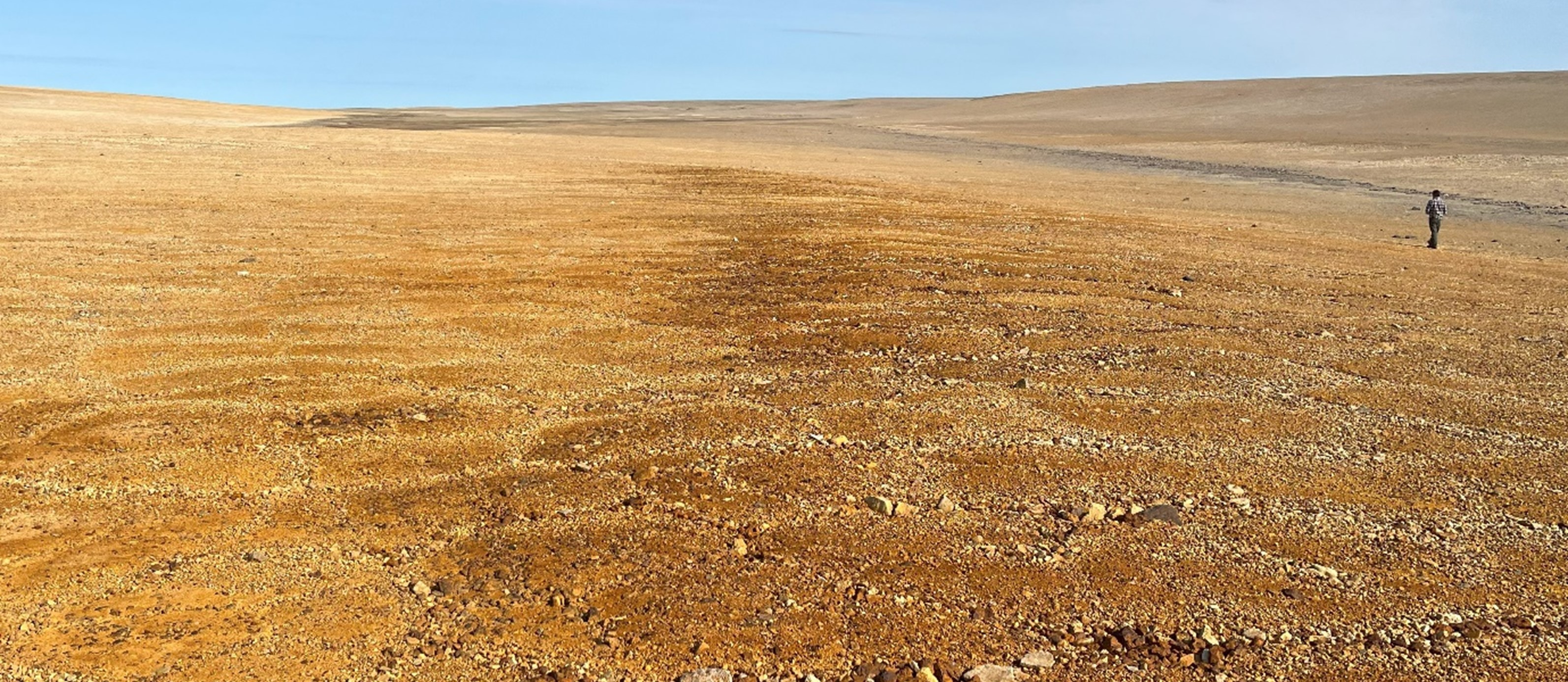
Figure 5: Photo of the southern Tempest copper/zinc gossan (brown/reddish rocks), looking north.
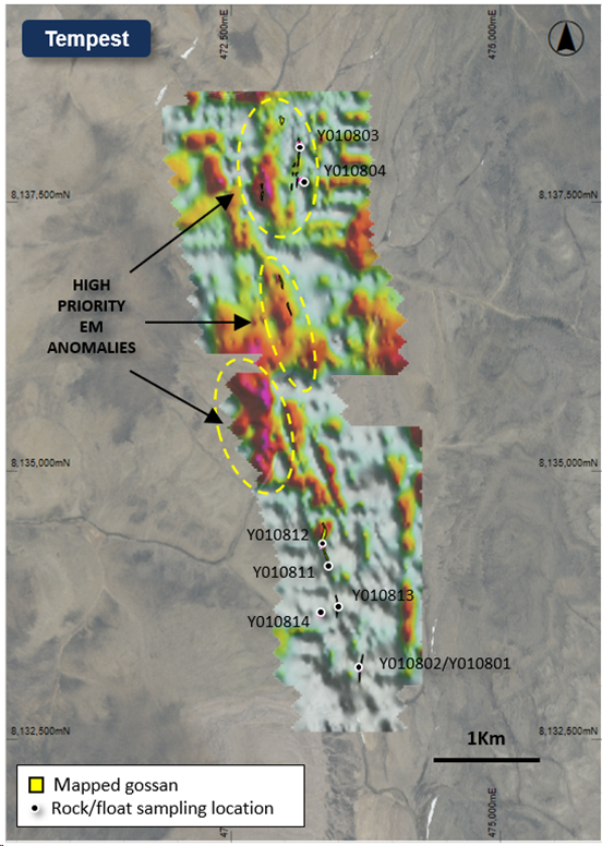
Figure 6: Plan view map of the Tempest Prospect showing the mapped gossans and geochemical sampling points, overlaying TDEM image (late time conductivity - Gate 6) and aerial photography.
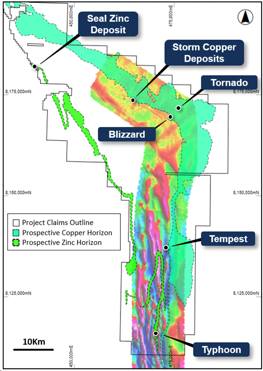
Figure 7: Map of the Project area showing the known copper and base metal deposits/prospects overlaying magnetics (Airborne GeoTEM - hotter colours indicate higher magnetic intensity). The Tempest Prospect is located approximately 40km south of Storm Copper.