Join today and have your say! It’s FREE!

Become a member today, It's free!

We will not release or resell your information to third parties without your permission.
Please Try Again
{{ error }}
By providing my email, I consent to receiving investment related electronic messages from Stockhouse.

or

Sign In

Please Try Again
{{ error }}
Password Hint : {{passwordHint}}
Forgot Password?

or

Please Try Again {{ error }}

Send my password

SUCCESS
An email was sent with password retrieval instructions. Please go to the link in the email message to retrieve your password.

Become a member today, It's free!

We will not release or resell your information to third parties without your permission.
Quote  |  Bullboard  |  News  |  Opinion  |  Profile  |  Peers  |  Filings  |  Financials  |  Options  |  Price History  |  Ratios  |  Ownership  |  Insiders  |  Valuation

Slam Exploration Ltd V.SXL

Alternate Symbol(s):  SLMXF

SLAM Exploration Ltd. is a Canadian junior resource company holding a portfolio of gold and base metal projects. The Company is engaged in the acquisition, exploration and development of exploration and evaluation properties in New Brunswick, Nova Scotia, and Ontario, Canada. The Company's projects include Mine Road Project, Menneval Gold Project, Ear Falls Lithium Project, Jake Lee Gold Project, Highway Gold Project, Keezhik Gold, Dam Lake Project, and others. The Mine Road Project is a significant addition to its portfolio of wholly owned BMC projects that include Goodwin, O'Hearn-Strachens, California Lake, Lower 44, LBM, North Rim, Portage, Satellite, Nine Mile, and Red Pine. The Highway project has demonstrated polymetallic potential with 10 known mineral occurrences that include zinc, silver, copper, cobalt, molybdenum and tin as well as gold. The Company holds NSR royalties on the Wedge copper zinc project, Ramsay, Reserve Creek, and Opikeigen gold projects.


TSXV:SXL - Post by User

Post by Wangotango67on Sep 07, 2024 4:51am
116 Views
Post# 36212930

TWINS

TWINSYup... there are two Y roads.

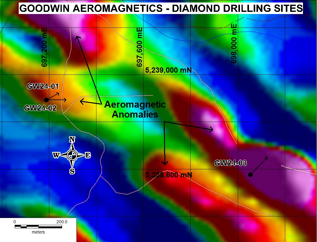
Geophysics map shows a Y road that leads atop mountain.
This Y road on geophysics map also has a straight eastern line ( part of Y )
Can't be Maliseet.... there's no road there.
So which Mountain is this ?
Keep reading.

https://www.thenewswire.com/data/tnw/clients/img/864a3a546dff7a70b54be5bb65739afe.png


Let's now compare both Y roads

Y #1
Y shape
Straight eastern arm
Belly lower of Y  ( round dip )

Y # 2
Y shape
Straight eastern arm
But where's the lower belly ( round dip ) ?
Look at the geophysics map - there's the Y road, eastern straight arm and belly
outlined in black.... but belly not seen on satellite map.

How can one know geophysics map is Y road # 2 related ?
Because the road courses up upon a smaller range and then up upon Venning mtn.

Since there are two Y roads with 3 matching traits...
I'll let others decide where - new + historical holes are located.
With all the reports i've read over the years... never have i come across 2 roads being same.
ufb.

I've also pointed out
road crew lower venning
and if one really zooms in.... they'll see what i've seen.
Trenching ( labelled on map )

open map in new window

https://live.staticflickr.com/65535/53975956162_caa3b6126c_c.jpg


It's no wonder i've tripped and stumbled trying to locate historical + new drills
for Goodwin.... who would've thought - twin Y roads.
Grrrr.


Cheers....


<< Previous
Bullboard Posts
Next >>