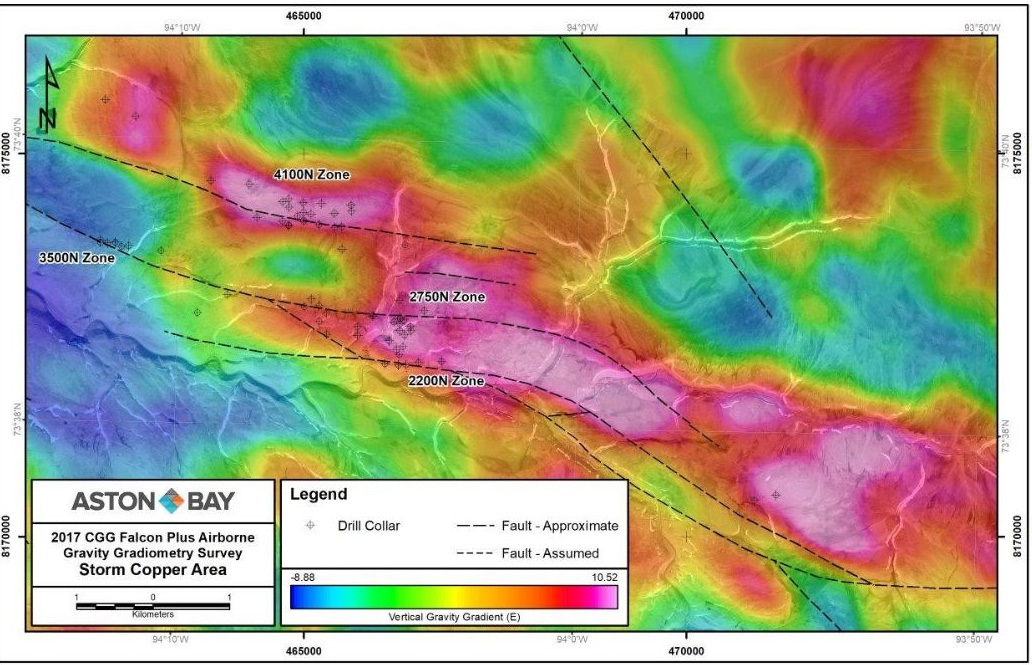
Sniper Drilling .Looking at slide, notice the 3 zones 4100,2750,&2200 all indicated here in pink with black dots being drill collars. The 3 zones here in pink are surface zones..The RC drilling on going is defining a surface resource including historic holes to combine into a 43-101 .
This would be a DSO SURFACE stripping operation..
PS, again notice now the second level of open-pit mining here,. Reference the whiteish anomalies with pale pink borders Notice Hole # 1 was drilled thrugh the surface pink 4100 zone and cut through the fault and down into the 2 nd level anomaly. You can see the two levels in the drill log on web.
Hole # 2 , seen here struck the center of level 2 anomaly 680 feet from hole # 1 and most Importantly at the same Horizon. Notice hole # 22 -10 from last year was drilled 500 feet west of hole # 1 hole and again most importantly at the same horizon.
Hole # 3.. Holy Thunder, struck a major intersection at near surface and also continued down and sruck the lower 2nd level anomly and again most importantly at near the same horizon..
PS,. Hole # 4,.notice the distance between hole # 4, & # thunder hole # 3,.4k,..This Southern Fault holds a major string of anamalies seen here on black lines ( faults Legend )
PS, Level three,..\\ Notice in Legend box, marked Deep Flem conductor, the flat rectancular plates all sit near faults and under the second level anomalies . The new Gravity survey over laid over the EM survey has made a gelogical advancement..
Notice , being a sniper,.the 5 drill holes were all drilled at intersections and and at corners and edges of anaoalies as to on purpose define a large sediment base and not waste money.
PS,..Zonation of minerals, looking here at image and seeing the holes were drilled at edges of anomalies i due not expect stellar results at this first pass. The mineral zonation would have settled more so into the center of the anomaly but just my opinion,. 
Figure 3: Total bouguer gravity image of the Storm area, fault architecture, drill hole and deep FLEM conductor locations overlaying aerial photography.
PS,..NOTICE here on 2017 image,..The zones sit at the fault which looks like a large tree,.. The hot saline when flowing would have flowed through these faults leading upto surface into the 4100, 2200, and 2750 zones..